What: Print Maps
Who Developed For: Archdiocese of Milwaukee
When: December 2015 – June 2016.
Why: To make the locations of all Archdiocesan churches and schools easily accessible to church staff.
How: QGIS and Adobe Creative Suite.
Award: Best in Category, Reference Map: 2017 Wisconsin Land Information Association Poster Contest
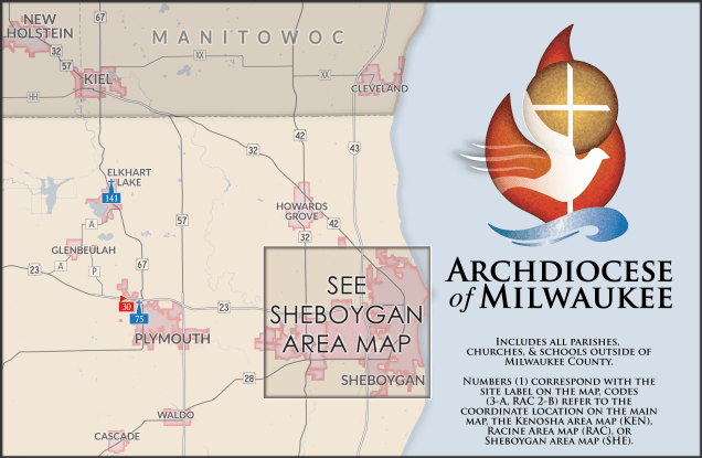
In late 2015, I was asked to provide a reference map of over 300 churches and schools in the Archdiocese of Milwaukee. In ways that both the client and I were surprised to see, we needed to gather location information for many of these churches and schools. To ensure an accurate listing, I researched parish and school websites to find all open schools and chapels with weekly masses. This research was coupled with Archdiocesan resources to make a comprehensive inventory of sites, complete with addresses and geographic coordinates.

The map was designed in as two 2′ x 3′ sheets, one to focus on highly urbanized Milwaukee County and another for rural and suburban parts of the Archdiocese. Once they were finally printed at an even larger scale, they worked as a great pair of reference maps. They even earned shared wall space in the entryway of the Archdiocesan office building, with a photo of Pope Francis!

On a design note, since I was asked by the Archdiocese to assemble this map, I set the design to flow with the brand of the Archdiocese. This entailed using a color scheme that worked with their logo and font families that matched or complemented the Trajan font in their logo. I even used an approximate silhouette of one of the churches to make the church icon on the map! For more information on the design and quirks that went into this project, I highly encourage you to check out my presentation at the 2017 North American Cartographic Information Society Annual Conference, featured here.
