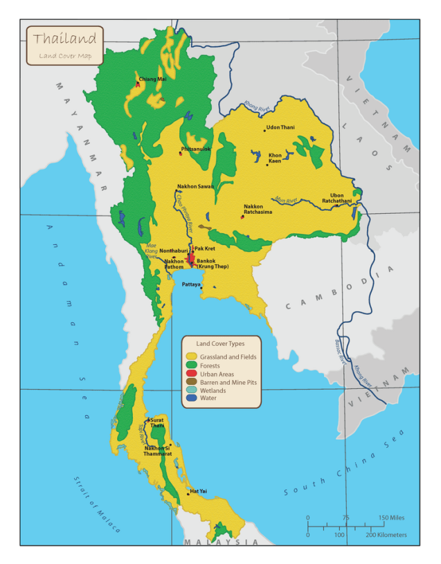
This map is unique in my collection of maps as it was assigned as a project with a one-day turn-around time. The original data set was a highly detailed land cover shapefile that I generalized into six easily decipherable land cover classes. With the assignment specifications asking to have the map be used in a middle school textbook, colorful classes and textured land surface were used to make the map “youth-friendly.”
